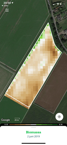
Biomass map
The Biomass Map measures the amount of biomass in a field and its variation.
Is short this covers how much foliage of leaf masse the field has. The pattern of biomass is the result of various growth factors. If you put this map alongside theSoil Zone map and Nitrogen Map, you can purposefully check the plot to see what is going on.
The indicator shown with the Biomass map is the WDVI. This value represents the amount of biomass in the field. This vegetation density is always expressed on the zero to one scale. At zero, there is no vegetation. With one, the vegetation is completely dense and green.
Pay close attention to the values in the legend. By default, the map shows a dynamic scale to optimise the visibility of the differences within the plot, but the colour green (or brown) does not represent the same amount of biomass. You can also choose a static scale, in which the colours are fixed values, but the variation is harder to distinguish. This enables you to compare plots to each other.
Map overview
Crop monitoring
Soil